
TL;DR
Recent studies using digital analysis show the Piri Reis map exhibits geometrical precision that defies 16th-century technology. This raises questions about ancient cartographic knowledge and its possible connections to Columbus.
Recent digital analysis of the Piri Reis map reveals that its underlying geometry is far more precise than previously believed, suggesting the use of advanced surveying techniques in the early 16th century. This discovery has implications for understanding the history of cartography and the possible influence of Columbus’s lost charts.
Using modern cartometric methods, researchers such as M. Marelić and B. Šlaus have analyzed the Piri Reis map, a 16th-century Ottoman world chart, and found that its regional “tiles” demonstrate a geometric accuracy nearly twice that of the composite map. The map’s depiction of the South American coast, including the Amazon and Orinoco river mouths, deviates less than 50 kilometers from modern GPS data, a feat unlikely for its era.
The map is known to incorporate sources like Ptolemaic and Portuguese charts, along with a purported “lost” map by Christopher Columbus. The inscribed claim that Columbus’s own map influenced the Piri Reis chart has fueled speculation about the existence of advanced, perhaps even ancient, geographic knowledge. The map also features illustrations of fauna and mythical creatures, blending empirical data with folklore.
Additionally, the map’s southern edge appears to show the coast of Antarctica without ice, or possibly a distorted South American coastline, sparking ongoing debate about its true representation. These findings suggest that Ottoman cartographers may have had access to sophisticated surveying data, challenging assumptions about medieval navigation technology.
Implications of Advanced Ancient Surveying Techniques
The discovery that the Piri Reis map exhibits such high geometric precision raises questions about the level of ancient surveying knowledge. If Ottoman cartographers used instruments or methods more advanced than previously thought, it could reshape our understanding of medieval and early modern navigation and mapmaking. Furthermore, the potential link to Columbus’s lost charts fuels speculation about the preservation and transfer of geographic knowledge across civilizations, possibly indicating a forgotten tradition of advanced seafaring and mapping.
This matters because it challenges the narrative that such accuracy was impossible before modern technology, opening new avenues for research into ancient navigation, lost civilizations, and the history of exploration. It also impacts current debates about the origins of certain geographic features, such as the Antarctic coastline and early transoceanic contact.
historical navigation tools
As an affiliate, we earn on qualifying purchases.
As an affiliate, we earn on qualifying purchases.
Historical and Archaeological Background of the Piri Reis Map
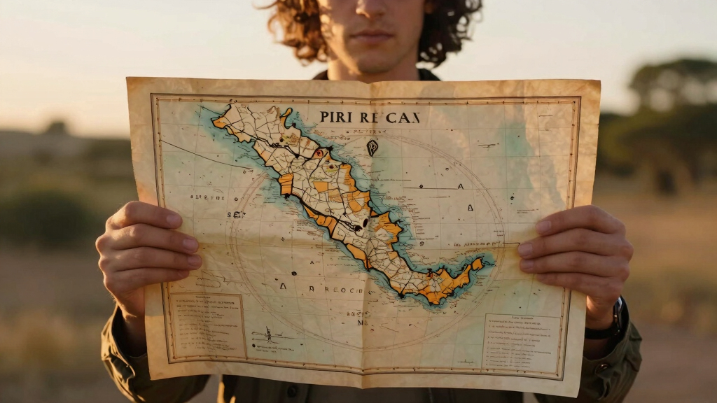
The Piri Reis map was created in 1513 by Ottoman admiral and cartographer Piri Reis, compiling at least 20 source maps, including Ptolemaic, Portuguese, and Columbus’s alleged “lost” map. Its depiction of the New World, especially South America, has fascinated scholars for centuries, partly because of its remarkable accuracy and the inclusion of fauna and mythical creatures.
Recent analysis indicates that the map’s geometric layout suggests the use of sophisticated surveying techniques, possibly involving early trigonometry, which would have been unlikely for the period. The map also features an inscription linking it to Columbus, fueling theories that it may incorporate even older geographic knowledge.
Other Ottoman maps, such as Hajji Ahmed’s 1559 cordiform map, show similar advanced geographic features, including a land bridge across the Bering Strait, hinting at a broader tradition of detailed cartography within the Ottoman Empire during the Renaissance.
“The geometric precision of the Piri Reis map suggests the use of survey methods far more advanced than expected for its time.”
— M. Marelić
ancient surveying instruments
As an affiliate, we earn on qualifying purchases.
As an affiliate, we earn on qualifying purchases.
Unresolved Questions About the Map’s Origins and Accuracy
While digital analysis demonstrates the map’s geometric precision, it remains unclear how Ottoman cartographers achieved such accuracy with 16th-century technology. The exact methods and instruments used are still unknown, and whether the map truly depicts Antarctica or a distorted South American coastline is debated. Additionally, the authenticity of the claimed Columbus source and the extent of ancient geographic knowledge involved continue to be subjects of scholarly debate.
trigonometry navigation kit
As an affiliate, we earn on qualifying purchases.
As an affiliate, we earn on qualifying purchases.
Future Research Directions and Potential Discoveries
Researchers plan to employ further digital modeling and archaeological investigations to uncover possible sources or tools used by Ottoman cartographers. There is also ongoing analysis of other Ottoman maps for similar features, which could shed light on the extent of their geographic knowledge. Excavations and archival research may reveal more about the “lost” Columbus maps and their influence. The scientific community will continue to scrutinize the map’s details to better understand the history of cartography and ancient navigation techniques.
antique map reproduction
As an affiliate, we earn on qualifying purchases.
As an affiliate, we earn on qualifying purchases.
Key Questions
How accurate is the Piri Reis map compared to modern maps?
Recent digital analysis shows that certain coastlines, especially in South America, are depicted with deviations less than 50 kilometers from current GPS data, which is remarkably precise for its time.
What does the map reveal about ancient navigation techniques?
The high level of geometric accuracy suggests the use of sophisticated surveying methods, possibly involving early trigonometry or advanced instruments, which challenges previous assumptions about medieval navigation technology.
Is the Antarctic coastline shown accurately on the map?
There is debate over whether the southern edge of the map depicts Antarctica or a distorted South American coastline. Recent analysis suggests it may represent an ice-free Antarctic coast or a geographical illusion.
What is the significance of the inscriptions linking Columbus to the map?
The inscription claiming Columbus’s influence raises questions about the transmission of geographic knowledge and whether the map incorporates ancient or lost sources predating the 16th century.
Could the map be evidence of lost civilizations?
While some fringe theories suggest advanced ancient civilizations, mainstream scholars focus on the possibility of an advanced medieval Mediterranean seafaring tradition, though definitive proof remains elusive.
Source: Ancient Origins